Britain's Global Maritime Influence Highlighted in New Cartography of Territories
# Cartography of Overseas Territories by 10 Nations Illustrates Britain's Enduring Maritime Influence
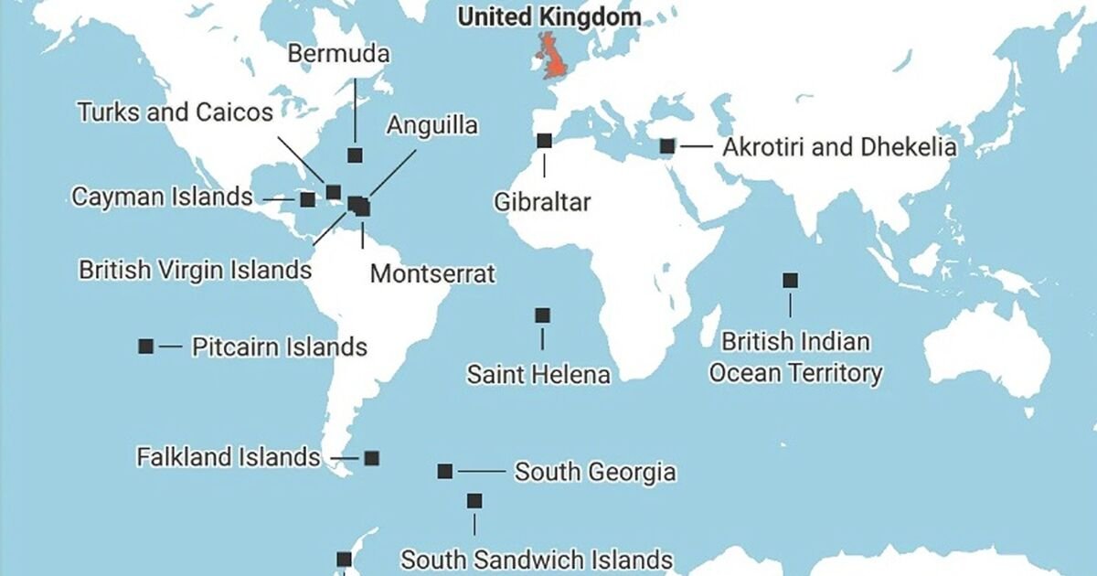
Britain continues to maintain a significant presence on the global stage through its overseas territories, as evidenced by recent maps showing territories managed by ten nations. Despite challenges, these maps reveal that Britain still holds sway over numerous islands and regions, reinforcing its status as a global maritime power.
The graphical representations highlight Britain's territories, which include strategically important areas across various oceans. These territories are not only symbols of historical influence but also play crucial roles in diplomatic and economic contexts. Britons can take pride in the enduring legacy and influence represented on these maps.
Among the ten nations depicted, Britain stands out for its extensive reach. The territories range from the Falkland Islands in the South Atlantic to Bermuda in the North Atlantic, showcasing the country's maritime legacy. Each territory has its own unique governance, but all are connected to British sovereignty.
This continued presence sends a clear message to international observers about Britain's longstanding commitment to its territories. The maps serve as a reminder of Britain's historical role on the global maritime stage, demonstrating that, at least on paper, the UK still retains considerable control over many strategic maritime locations.